New Zealand and Tasmania Trip

Mount Ngauruhoe - Richard Blair photo

By Kathleen Goodwin

Link to Richard Blair’s photos from New Zealand.

We  are back from a month long trip to New Zealand and Tasmania. We highly recommend both for their beauty, good food and friendly people.  We flew directly, leaving San Francisco on Air New Zealand and arriving in Auckland 13 hours later.  We rented a Toyota Corolla and drove on the left, not difficult for me as I grew up in South Africa where that’s the norm. Apple Siri was essential for our entire trip in both countries.

We made our way to our friend Golda Kunin’s home in Swansea, outside of Auckland. Her house overlooks a valley of tree ferns, trees and thick bush. Golda took us exploring at Bethells Beach, fed us and was a great hostess! Next we went north for the day to Tāwharanui Regional Park, a wild peninsula on the east coast.

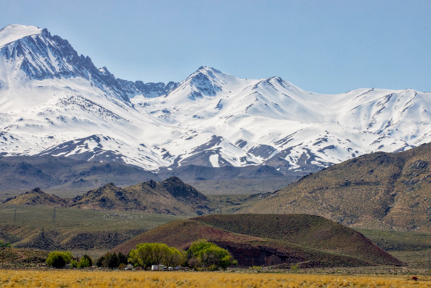
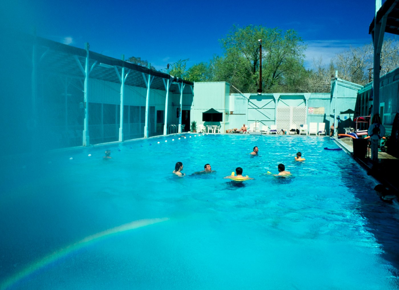
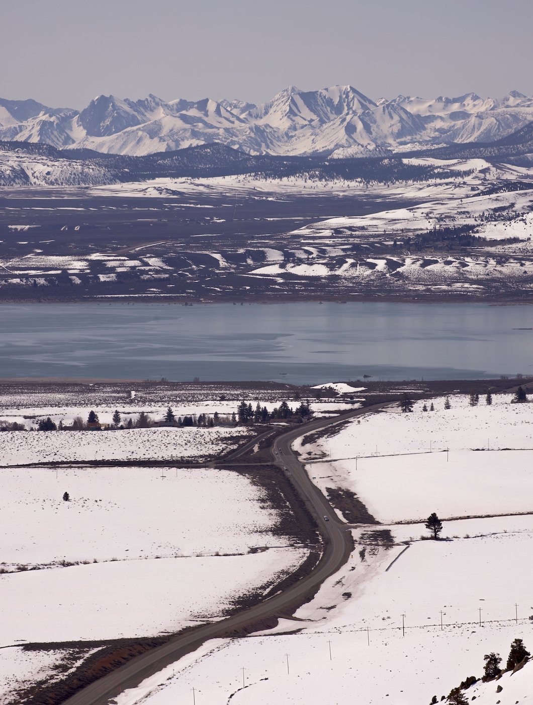
After a few days rest we left Golda’s house to discover the island on our own, going south to Rotorua, where we explored the geothermal pools. Below that was Lake Taupo, an immense caldera which filled with water after the volcano exploded about 1800 years ago. It was the most violent eruption on earth in the last 5000 years! Ancient texts in China and India note how the sunsets were red then.

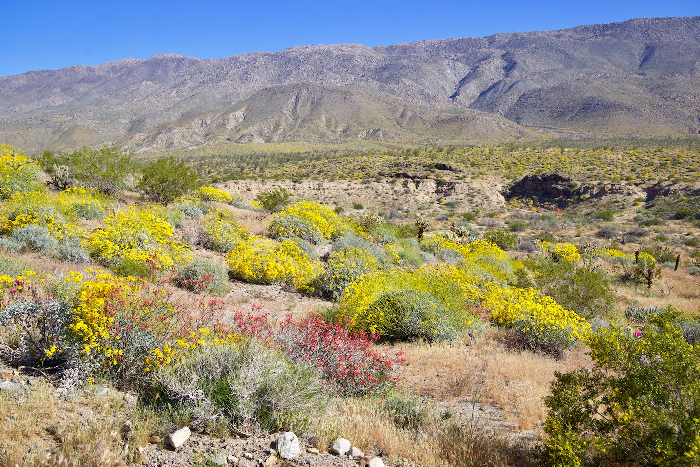
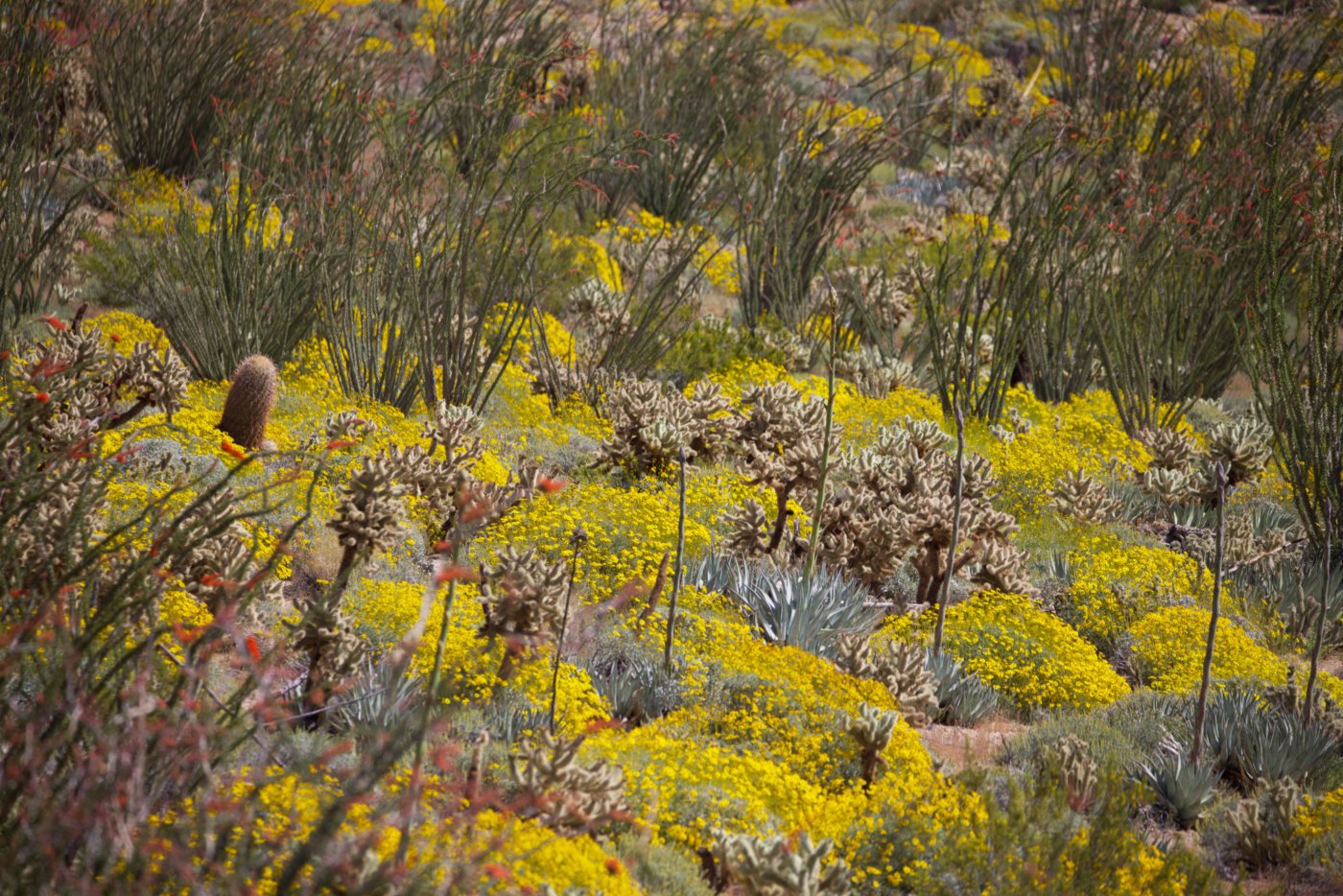
National parks are the pride of New Zealand, and there are fantastic trails (called tracks) to hike or mountain bike. The parks are free. People take their trash home with them, so there are few rubbish bins around but very little litter. 

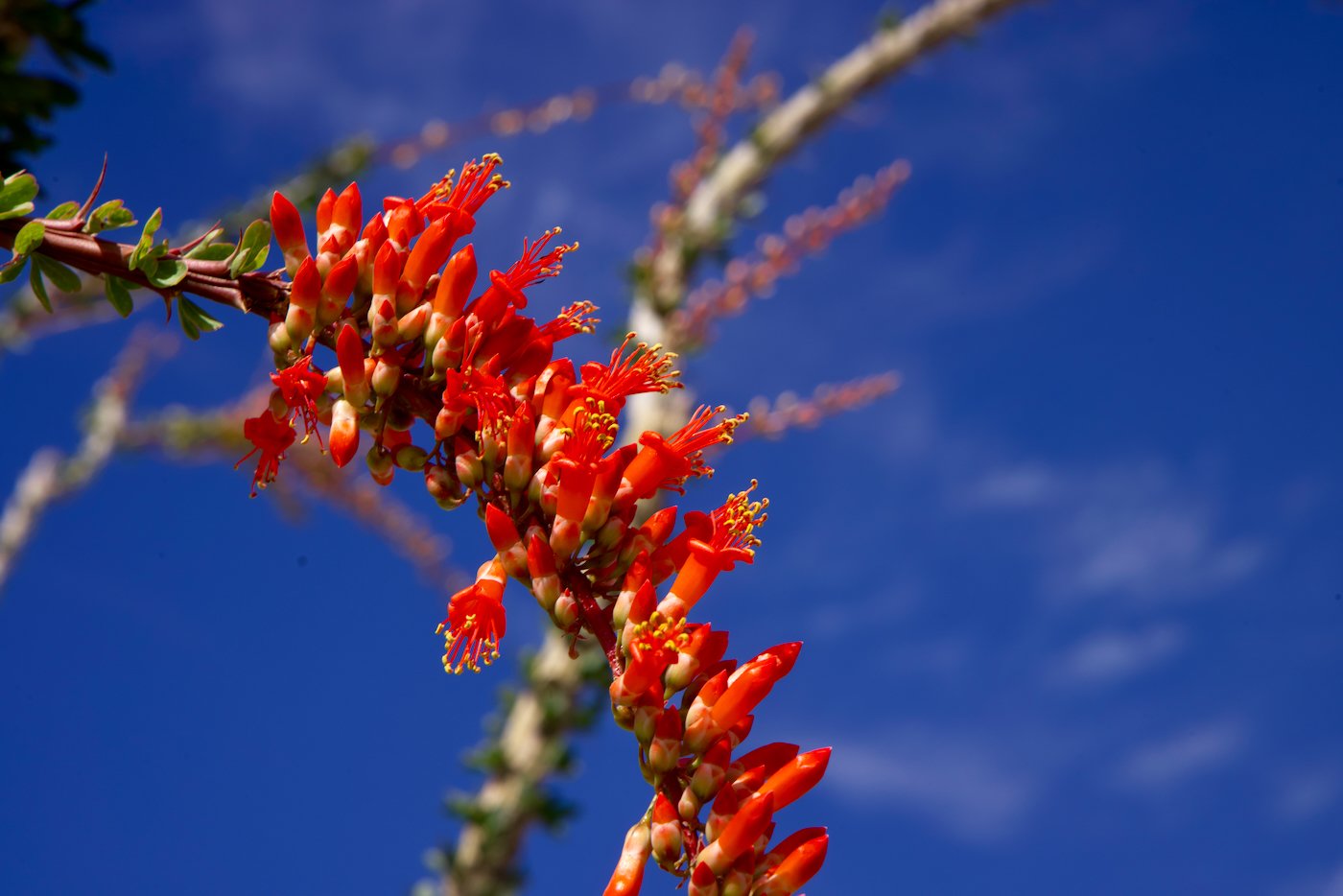
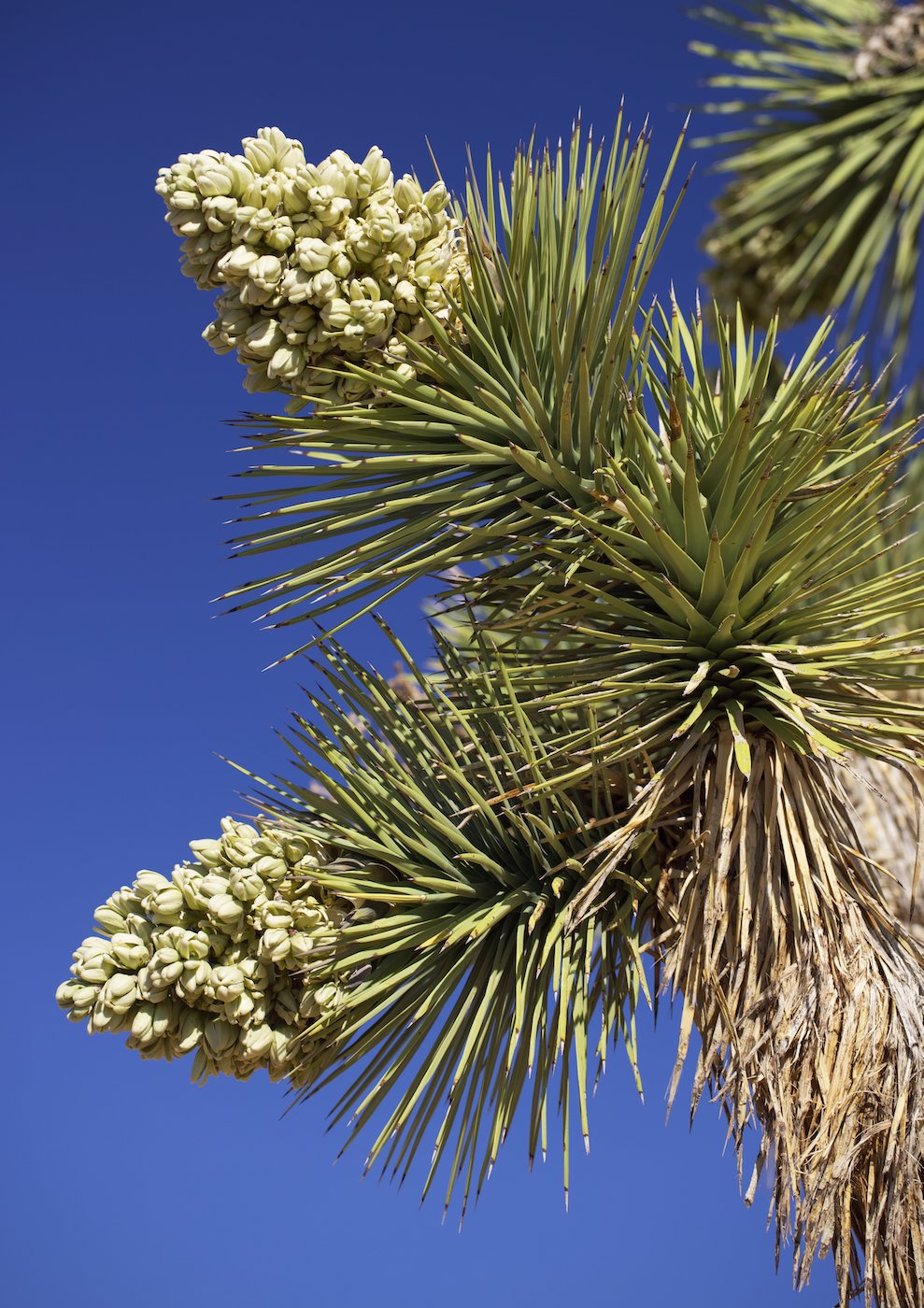
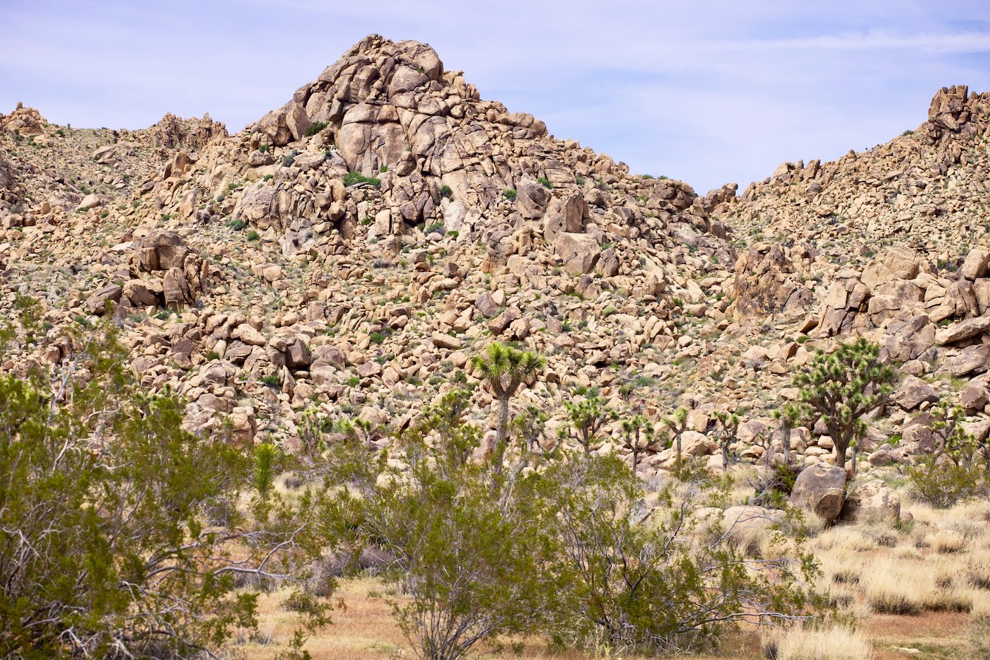
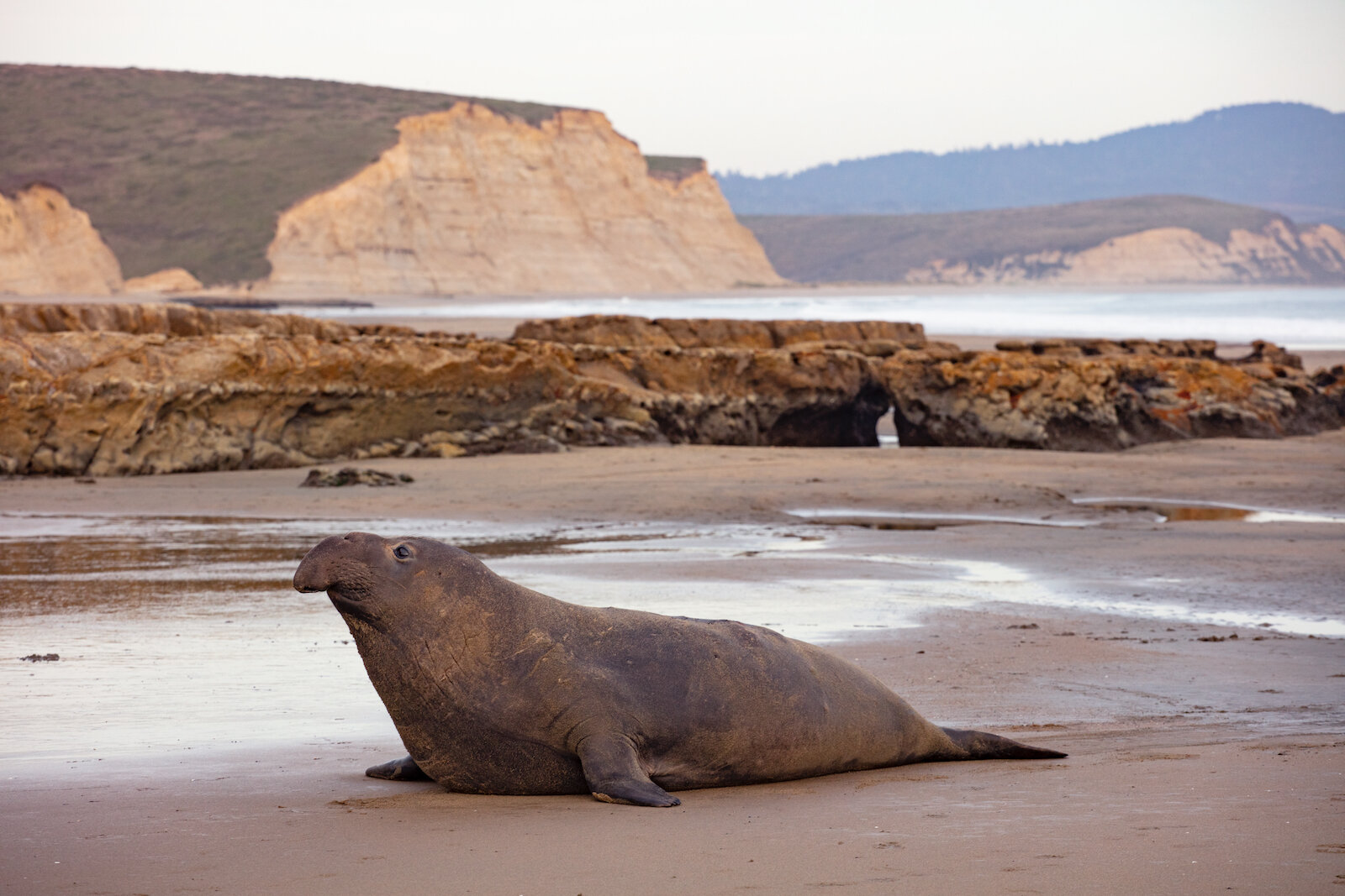
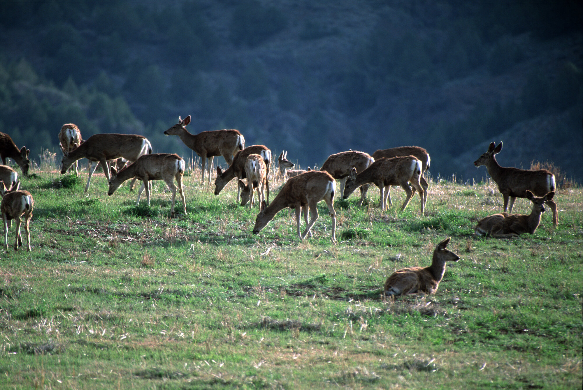
In Tongariro National Park, the classically shaped volcano, Mount Ngauruhoe, was stunning, the top clearly showing with a fluffy white cloud hanging just above it.  The Tongariro Alpine Crossing is world famous but it was too early in the season for anyone to attempt it, due to deep snow. We did take a walk through the forest nearby and saw the Tawhai Falls in full force.

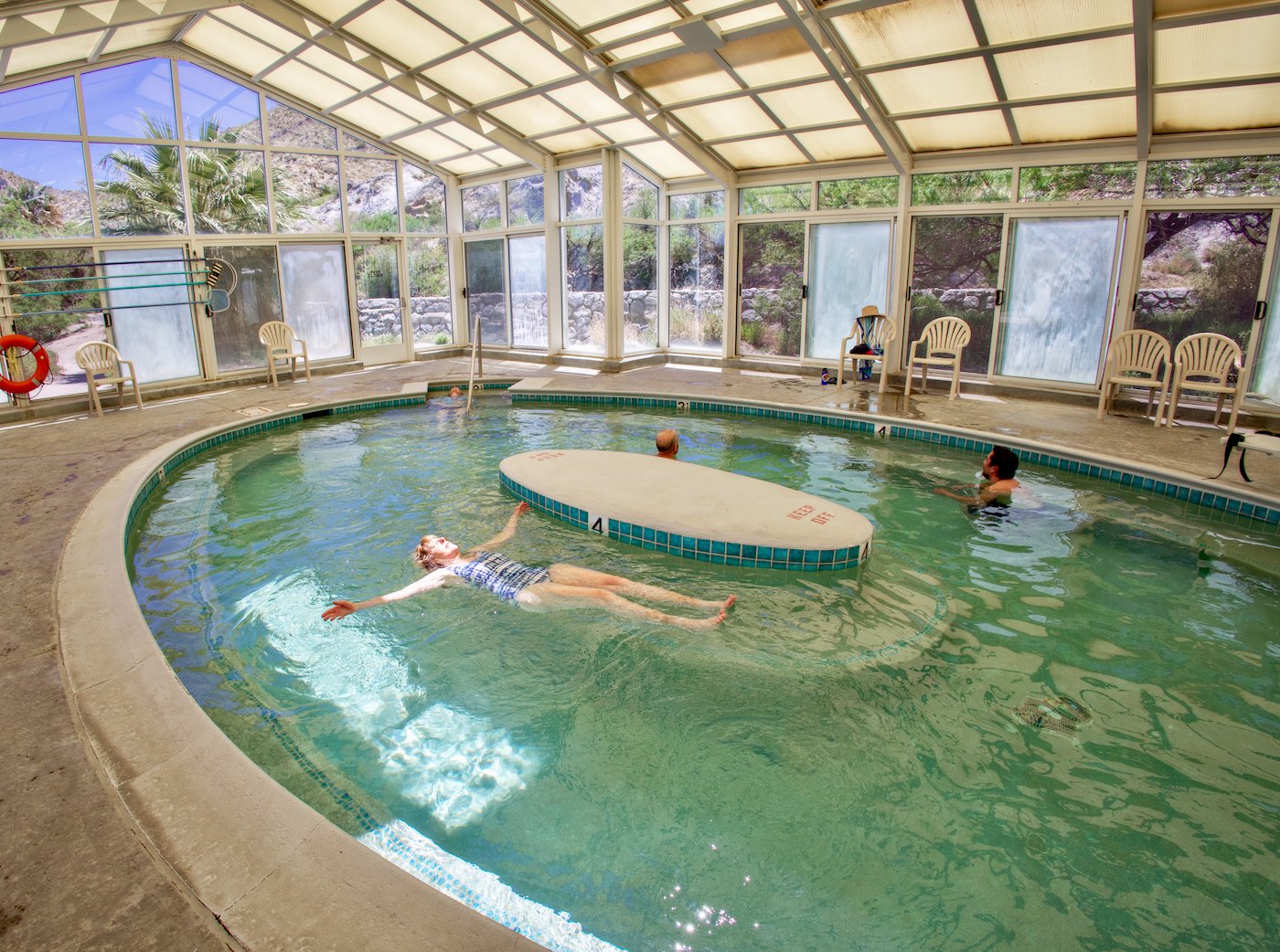
We stayed in Turangi, on the southern end of previously mentioned Lake Taupo, at Creel Lodge, the nicest place we found on our trip. It is owned by Peter Deakin, commonly known as Peter, the Fish. People stay there for the trout fishing in the Tongariro River which adjoins it. We did not fish but enjoyed the beautiful setting which Peter has created with flowering bushes, tree ferns and outdoor door dining areas. An avid sailor, he sailed around the world on a replica of the H. M. Bark Endeavour that Captain James Cook sailed on his first world trip. Peter wears a gold earing earned by rounding Cape Horn on the square rigger! He was a commercial fisherman in New Zealand for 34 years and pioneered catching orange roughy which are now a prized fish. Near Turangi is the Tokaanu geothermal public baths which we soaked in.

On Peter’s recommendation, we drove over to Whakatane on the coast of the Bay of Plenty. The next morning we drove  along the ocean on high cliffs reminiscent of Big Sur going to the North East. We followed the winding road (Highway 35) until we got to Waihaiu Bay, where the road turned inland. We retraced our steps to Whakatane that evening.

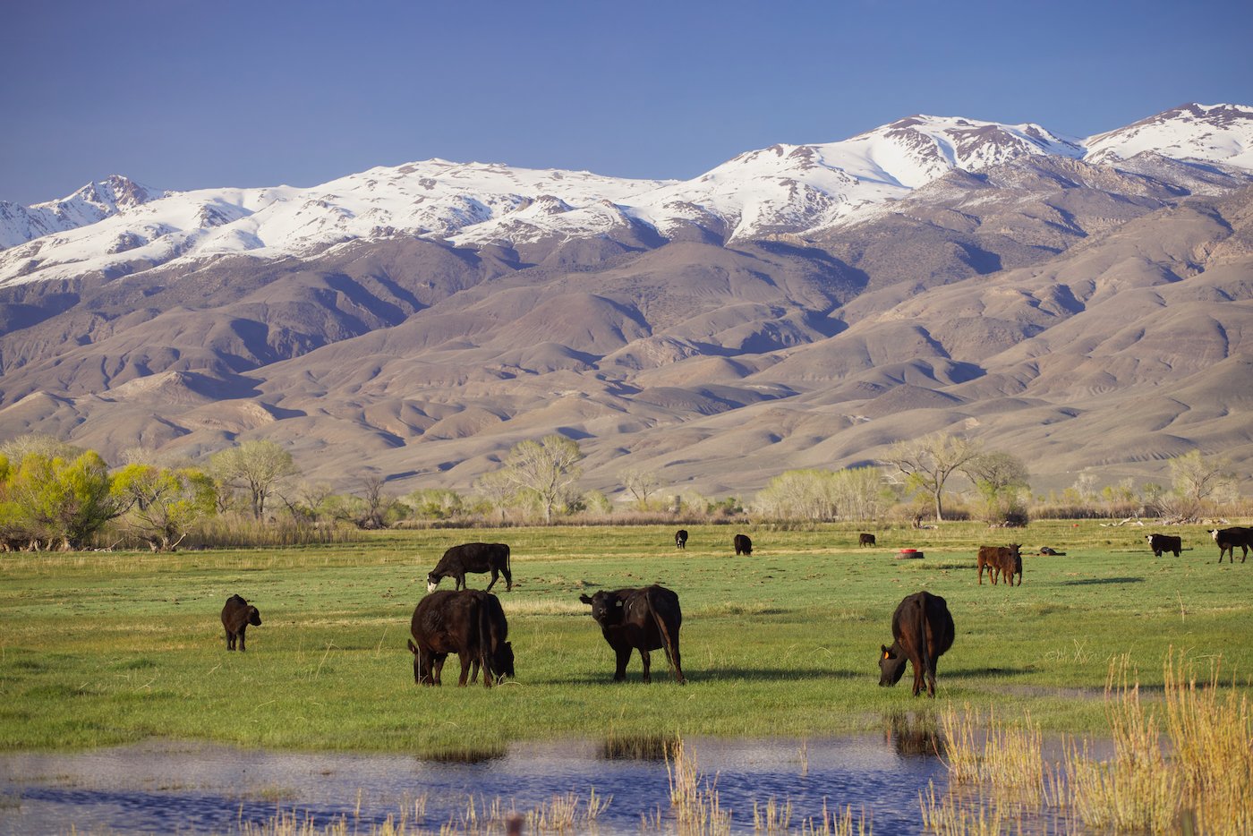
Our next exploration was the Coromandel Peninsula, staying in the town of Thames (though we couldn’t find the London Bridge).  I think New Zealand countryside with its green hills, cows and sheep is similar to England except New Zealand has a bigger scale. The narrow coast road was scenic with many beaches and parks which we enjoyed.

On our way back to Auckland we visited Tapakanga Regional Park which featured a 12 foot Maori carved picture frame.  It was carefully placed  - revealing a beautiful scene of ocean and coastal cliffs through it - actual artwork of nature.

We took a three hour flight to Tasmania landing in Hobart where many of my relatives live. My sister Fay and her family emigrated to Australia in the late 1970’s to flee apartheid in South Africa. They settled in Hobart, the main city of Tassie.  Our stay involved many family dinners. We did travel around the island for about a week. We visited the Museum of Old and New Art (MONA) which is remarkable for its architecture and sculpture. It was designed by Fender Katsalidis 

We also had an introduction to Royal Tennis which is a combination of lawn tennis and squash, quite popular in Hobart, which built its first court in 1875. It started in England in the 13th century. As a young man, Henry VIII was a keen and talented tennis player who spent hours on court. His second wife, Anne Boleyn, was gambling on a game of tennis when she was arrested to be taken to the Tower of London. She complained that she couldn’t collect her winnings.  Lawn tennis and squash evolved from Royal Tennis.

We stayed in Battery Point, a suburb of Hobart on the Tasman Sea, 15 minutes from the city center. It has narrow streets and is filled with ornately decorated Victorian-era wooden houses.

A highlight was an inflatable boat trip to Bruny Island complete with a humpback sighting, dolphins, gannets and many seals. The boat went close to the cliffs and we saw unusual rock formations and waves exploding out of sea caves.

Being an island, Tasmania has some unique wild life like wombats, echnida and the Tasmanian devil. We visited Bonorong Wildlife Sanctuary which rescues ill and orphaned animals with the goal of releasing healthy animals into the wild. Where possible the animals live in large open areas. We could walk around among kangaroos. I photographed them mating. It seemed quite tender to me. Afterwards the male held on to the female and touched her ears with his mouth. The zoo keeper however called it “rootin’ roos.”

The echidna looks like a hedgehog but is not related. It has a snout that functions as both mouth and nose, and electro-sensors to find earthworms, termites, ants, and other burrowing prey. It has a tiny mouth and toothless jaw, and feeds by tearing open soft logs and anthills then licking off prey with a long, sticky tongue. Its ears are slits on the sides of its head under the spine. 

Echidnas and platypuses are the only mammals that lay eggs. The female echidna deposits the egg directly into her pouch. Ten days later, the baby opens the leather shell with a temporary reptile-like egg tooth. A young echidna, called a puggle  sucks milk from the pores of the two milk patches and remains in the pouch for 45 to 55 days when it starts to develop spines. The mother digs a nursery burrow and deposits the young, returning every five days to suckle it until it is weaned at seven months. Puggles will stay within their mother’s den for up to a year before leaving.

Wombats look like cuddly bears but they can bite people - they do not make good pets. Female wombats give birth to a single young after a gestation period of 20–30 days They have backward pouches for their young.  Wombat babies leave the pouch after six to seven months, are weaned after 15 months, and are sexually mature three months later.

Tasmanian devils are only found in Tasmania having become extinct in Mainland Australia 3500 years ago. It is the largest surviving carnivorous marsupial, and has a squat, thick build, with a large head and a tail about half its body length. Its forelegs are slightly longer than its hind legs, and devils can run up to 8 miles per hour for short distances. The devil stores body fat in its tail which acts as a counterbalance to aid stability when it is moving quickly. A scent gland at the base of its tail is used to mark the ground behind the animal with a strong, pungent scent. The Tasmanian devil has the most powerful bite relative to body size of any living mammalian carnivore. The jaw can open to 80 degrees, allowing the devil to generate large amounts  of power to tear meat and crush bones, even bite through thick metal wire. The long whiskers on its face and in clumps on the top of the head help the devil locate prey when foraging in the dark, and in detecting when other devils are close during feeding. Females reach sexual maturity in their second year and become fertile annually. Gestation lasts 21 days and they give birth to 20 to 30 joeys. They stay in a backward pouch where there are just four nipples so the survival rate is low. They leave the pouch after 105 days, then stay in a den for another three months before venturing out on their own.

We now set off to explore more of the island, heading to Bicheno on the north coast. It has stunning beaches with white sands but was windy, cold, and rainy during our visit - which made traveling challenging. However at Cape Tourville Lighthouse on the Freycinet Peninsula the sun broke out briefly and a rainbow arced over the lighthouse. The was a scenic highlight of our trip in Tasmania.

Two of Tassie’ main attractions we missed were Lake St. Clare because of a steady downpour, and Cradle Mountain which was overloaded with visitors being bused in - shades of Yosemite Valley, so we passed. Tasmania is a beautiful island but the weather can be challenging and after a last farewell dinner party we went home.

Road Trip to the Desert Flowers

With all the rain in California this year, we knew the desert would be stunning. We chose to go to the less-visited Anza Borrego State Park, just 30 miles north of the Mexican border.  
By the time we packed the van, we had a late start and only made it to Paso Robles and its Walmart by midnight, remembering that it welcomed RVs to overnight park. One rather strange individual paced the parking lot all night but did not bother us. I generally despise Macdonald’s but I must say the egg mac-muffin and latte the next day went down very easily. The ATM nearby was convenient too. Is this camping?

And what a change from our wet cold winter. The temperature was perfect, with no wind and flowers all over. We made our way to Agua Caliente, a geothermal heated springs in the Anza Borrego Desert State Park. It has a  large warm indoor pool and two cooler outside pools. It is run by the San Diego County and costs $3 a day. We soaked there twice.  
Anza Borrego is a state park where you can enjoy dispersed camping.  One must leave no trace by packing in and packing out. We stumbled on to Blair Valley and camped there for two nights. It is just 16 miles away from the hot spring. We have not yet discovered why it is called Blair Valley. It is a dry lake, but this year it was covered with grass from all the rain.  
At the end of the valley is the Little Blair Valley Cultural Preserve and the Ehmuu-Morteros Trail, made by the Kumeyaay tribe who lived there. We found grinding holes in the rocks of the former village, called morteros (Spanish for mortar). The Kumeyaay would grind seeds from Yucca, Juniper, Cholla, Creosote, Ephedra and various other cacti and plants. Over the years they pounded mortar holes in the granite rocks as deep as 12 inches, others were much shallower depending on their use. Some of the large rocks which still line the trail, served as shelter, food storage or sweat houses. The dark soil and scattering of rocks nearby could be the remains of an Agave roasting pit. These were made by digging a deep pit and lining it with rocks and a layer of hot coals. Agave heads, stalks and leaves were placed on the hot bed of charcoal and covered with sand. Three days later the Agave would be ready to eat.
Further up the trail is a red and black pictograph. Black paint was often made by grinding up charcoal and adding oil from roasted Wild Cucumber seeds while the red paint came from iron oxide. Paintbrushes were made from Yucca and Agave fibers.

We drove a few miles south of Agua Caliente and came across the US border patrol looking to ambush migrants. They did not search the van and waved us through the roadblock.

We made our way slowly through Anza Borrego  Just outside Borrego Springs, we saw the work of sculptor Ricardo Breceda which is spread over 1500 acres of undeveloped desert land. The metal sculptures are large, the dragon spanning over 300 feet, parts of it being underground. The horses are larger than life size. It certainly warranted the side trip to see them.  
From there another surreal scene awaited us. Being weary and needing more supplies, we decided to sleep at the Walmart Supercenter in La Quinta. It had a surprisingly good array of fresh fruit and produce, some even organic. We were entertained by a veteran musician who was set up from the back of his car - not using it as his home, but rather as a stage. After playing for tips for a couple of hours, he left.  
The next night we set up in a wash outside Joshua Tree National Park and made our way to the park in the morning. This park was very different from Anza Borrego - many more people and fast drivers. Unfortunately, many people do not know that you actually see more if you drive slowly; you also will not injure the local wildlife.  
Perhaps we were too early but the flowers were not as spectacular as those in Anza Borrego. The weather was changing and the air was not as clear as before. After exploring the park for a couple of days, we decided to head north via Highway 395. Our next stop of significance was Fossil Falls. Originally an actual waterfall fed by the Owens River, it is now sucked dry by Los Angeles. You can see where pools were carved out by thousands of years of water running through. We made our way to Lone Pine, near Mount Whitney. We were happy we had a heater in the van as we were definitely back in winter. The Sierra was covered with snow and Mount Whitney was crystal clear. We continued north taking back roads along the foot of the White Mountain Range finally ending up at Keough Hot Springs and lo and behold another wonderful soak!

We camped at the Bishop campground run by Inyo County. The beauty was ahead of us at Mono Lake where snow reached its shores. We have never before seen so much snow here. In fact, Highway 395 was closed for a few weeks in February and March after avalanches inundated the road with 40 feet of snow over three miles of road. It was not fully reopened until April 7. We made our way slowly up the pass stopping at Conway Summit to admire the scene below.  We crossed over the mountain by Lake Tahoe. We broke up the long drive home with a great stop at River Bend Park near Sacramento, a beautiful spot with some friendly mallards.
Later that afternoon we returned home to Inverness.

California had never looked so beautiful. Our advice is go now!

Tales of Nadia

How our intrepid photo assistant got her driver’s license in Cairo. I wish that I had heard this story before I lent her my car!

Read More

Our E Bike Adventure

A few years ago, I got interested in e-bikes, reasoning that it was an easier job for a battery to transport a person on a lightweight bicycle rather than a car with all that weight - an enclosed room almost. First I was intrigued by the Copenhagen Wheel a motor designed by former MIT students, which was self-contained in a rear wheel. The idea is that you replace your old wheel on the bike with it, and control the wheel with a iPhone, attached to the handlebars. But the devil was in the details, and they seemed to never get it going in a mass market way.

Then a new generation of e-bike was designed, with the quality leader being Specialized, a high end bike manufacturer, But as much as I wanted one, the $7000 -$16000 price tag seemed out of reach. I also looked at other on-line bikes but among the 100’s of start ups problems arose - they would go out of business, making their warranties useless; and the quality of their parts tended to be very poor. Rad bikes seems like a good bike company but their designs were more for commuting and urban use, and their total weight seemsd excessive.

Finally I found Island City Bikes, who had the compelling idea of converting your old, loved bike to electric. This seemed great as Kathleen had an older, high quality mountain bikes which we loved to ride that was a dependable, long lasting model. It was worth about $500-$750 dollars, according to what we saw of Craig’s List. Island City would convert our bikes for about $2000 which is a lot of money but not too much compared to the fancy Specialized and Santa Cruz models which start around $7000.


Kathleen got her bike electrified first. We took turns riding the hills around our house in Inverness ridge, and it was a revelation. I always liked mountain biking but diabetes and old age really have taken a toil on my ability to climb steep grades. Besides running out of gas on hill climbing, there was a fear of falling off the bike and getting banged up because the slower you go the less stable you are. I guess it was a general fear of crashing that bothered me. With the new bike, Kathleen’s old Santa Cruz Heckler, I could decide how much power was supplied by the motor, and hills that were impossible for me to climb suddenly became easy. In fact the last section of the Bear Valley trail up to Divide Meadow, suddenly seemed not to be a hill! It used to be difficult to for me to ride without stopping to walk the bike and catch my breath.

Our photo intern, Nadia Negm, had to return to Egypt when her student visa ran out, and she left her bike with us. It was a 2001 Specializing S-Works bike that a neighbors had given her when he up-graded to a better bike. Impulsively I took it to Island City for an electric rebuild too. So now we have two bikes, and we can ride together. This gives us increased safety. If we have a crash, or a bike dies, the other person can go for help.

We have another neighbor, an astro-physicist who has a e-bike who told us, in essence: while you obtain super powers riding these bikes, they do not give you the reflexes, balance and healing ability of a teenager, so when you launch yourself into the wild blue yonder on a trail that you have no business riding on, you are going to get smashed. I had a near miss riding on the Inverness Ridge Trail when I passed by a tree that had broken across the path. As I zipped by I saw that there was a jutting spike of a broken limb which I just missing running into, at eye level. I could have lost my vision. After that I slowed down.

You really have to concentrate when riding e-bikes. It’s fun bing a kid again, but adult caution is learned through the experience of screw-ups over the years!

My experience with the bikes so far makes me think that they could improve life in cities because of the lack of exhaust, noise, ease of parking, and the fitness benefits for the riders. Inverstructure changes might be theft-proof locker parking spaces, and bike lanes that are safe from speeders. I saw many mothers with children riding electric bikes in Japan, where they rode on the sidewalk. These bikes were girls bikes - no crossbar- easy to step on and off them. The riders were polite and careful, reflecting their previous cargo - their kids. I wonder if Americans could restrain themselves from Rambo sidewalk moves??? I doubt people here will ever grow up, but in the meantime hopefully many of us will seek trails that are safe.

If you find this interesting - please send the link to friends, we artists survive on views!!

Island City Bikes

Island City Bikes

LADY CLAIROL HAIR COLORING FOR ELEPHANT-SEALS

by Thomas Holsinger

The marine biologists at UC Santa Cruz are probably the world's foremost authorities on elephant seals due to the proximity of the world's largest elephant seal rookery on Ano Nuevo Spit.  The following is a true story (I was there) about Lady Clairol's special hair dye for elephant seals and a confrontation between UCSC Professor Burney LeBoeuf and a secret naval CBW (Chemical Biological Warfare) research installation while I was an undergraduate (1967‑71).

The west coast elephant seals were almost wiped out by 19th century hunters; less than a dozen survived.  There are presently several thousand of them but their genetic diversity is nil.  Cheetahs have the same problem but the cause of their long-ago population crash is not known.  Bull elephant seals in good health can weigh over a ton; I don't precisely recall their length; at least a dozen feet is my best guess.  Their land maneuverability is wretched though they can lunge several times their own length in a forward direction.  These are the seals with the ugly long inflatable snout which lets them produce really amazing roars.

UCSC was too new to have a graduate program in 1967‑75 so Professors LeBoeuf and Peterson conscripted undergraduates to help them study elephant seals.  We used to have contests at night to see who could most realistically imitate the normal and special mating calls of sea lions and elephant seals.  The best way to perform the mating roar of a bull elephant seal was to drink 3‑6 cans of beer real fast (any carbonated beverage would do though) and then urp up all the C02 in one long belch, modulated by the larynx.  Dorm Seven sounded really strange at night during the elephant seal mating season.

One of the interesting aspects of elephant seal research was marking the bull elephant seals during the mating season so we could tell them apart.  This was initially done with sponges dipped in paint and nailed to 10' - 12' poles.  We would then approach the bulls from the rear side and try to dab paint on them in what we hoped would be a distinctive identifiable marking.  There is a great photo of Professor LeBoeuf doing this to the nose of a bull (carefully) from the left front side while it roared its displeasure at him, which was published in both the SF Chronicle and a World Book Yearbook.

Paint was unsatisfactory in identifying the bulls.  Yellow Splotch Left Shoulder left a lot to be desired as a name.  Worse, it would wear off in the salt water and constant rubbing of the bulls against rocks.  We had to constantly re-apply the paint and that was a hazardous job.  A lot of us saw elephant seal pup corpses which had been crushed by the bulls lunging at each other in mating battles.  It could have happened to us too.

Finally either Peterson or LeBoeuf had the idea of writing to the Lady Clairol hair dye company and ask them for help.  A few months later they got a phone call from the local Greyhound station saying that they had a parcel from the Lady Clairol company which had just been delivered (Greyhound shipped a lot of freight in those days).

The parcel contained a letter from the Lady Clairol company saying that their chemists hadn't had so much fun in years, instructions, one or more containers of concentrated shampoo, and several large squeeze tubes to apply it.  All we had to do was to mix the concentrated solution with water and suck it up into the squeeze tubes.  Voila!  Lady Clairol Special Hair Dye for elephant seals in a handy applicator (now known as Lady Clairol Blue to those unaware of its original name and research origin).  Just squeeze the stuff out on a bull elephant seal and it would pretty much bleach the fur.  And it would stay on for months until the old fur rubbed off and new fur grew in, even when constantly immersed in salt water.

We loved it. We could paint names on the bulls in letters 12"- 18" high. George, Fred, Super-Seal, etc. Easily identifiable, etc. Application required care though, but at least we didn't have to rub the stuff in real well the way we had to do with paint. This meant we could do it while the bulls were sleeping. One of us with a squeeze tube would creep up to a sleeping bull from behind while two more watched the bull's closed eyes with binoculars to catch the slightest sign of wakefulness and shout a warning to get out of there.

The marine biology department prospered.  The elephant seals prospered and started a rookery in an undisclosed location somewhere along the southern California coast.  Right next to a secret US Navy CBW research installation.  And the best beach from which we could launch boats to get to the new rookery was just within the boundaries of that installation.  The professors asked for permission to use the beach.  Permission denied.  No pro-communist hippies will walk around my command!  Remember that this was during the Vietnam War.

So we started naming southern California elephant seals Anthrax, CBW, Botulism, Tularemia, Name of Secret Installation, and Commander *** (using the real last name of the installation's commander).  Soon reports were swarming into the media that elephant seals with such words written on their sides were being seen.  It came to the attention of Naval Intelligence that military secrets were being advertised in two foot high letters on the southern California coast.

The ensuing negotiations between Professor LeBoeuf and the Navy were fascinating.  The UCSC marine biology department got permission to use the beach on this secret installation in exchange for no longer publicizing it, thanks to Lady Clairol super-special hair dye for elephant seals.

Mr. Holsinger graduated from West Marin Elementary School in 1963 and from UC Santa Cruz in 1971. Richard Peterson was his faculty adviser."

Elephant Seal with Big Nose - ©Richard Blair

Elephant Seal with Big Nose - ©Richard Blair

Dr. Sarah Allen, Marine Ecologist Modern method of tagging Elephant Seals (when they are sleeping)  - ©Richard Blair

Dr. Sarah Allen, Marine Ecologist Modern method of tagging Elephant Seals (when they are sleeping) - ©Richard Blair

Baby Elephant Seal Wants to Play ©Richard Blair

On Drakes Beach - ©Richard Blair

On Drakes Beach - ©Richard Blair

Itchy Nose! - ©Richard Blair

Itchy Nose! - ©Richard Blair

Drakes Beach - winter - ©Richard Blair

Drakes Beach - winter - ©Richard Blair

A pensive moment

A pensive moment

Elephant Seal Mating

Elephant Seal Mating

That’s all folks!

That’s all folks!

The Astonishing Beauty of Marin ...a landscape show by Kathleen Goodwin and Richard Blair

Elephant Mountain Sunset - Richard Blair and Kathleen Goodwin

Elephant Mountain Sunset - Richard Blair and Kathleen Goodwin

Artists Richard Blair and Kathleen Goodwin, are showing at Toby’s Gallery, in downtown Point Reyes, during the entire month of Ma.y. Viewing hours are 9am - 5pm. every day of the week.

They are known for their coffee table art books, including Visions of Marin, and Point Reyes Visions. They rarely exhibit on walls, as their preferred showplace is the printed page. But Goodwin's original paintings are large, and Blair photographs with the sharpest professional cameras.

Toby’s Gallery, once a hay barn, gives them a chance to escape the confines of a book, and show work in dramatic large sizes. Their artwork is a product of decades of concentrated creativity. Now that public health is better, they are able to exhibit again after a long hiatus.

Blair is using his stockpile of arts and crafts frames by Timothy Holton, widely regarded as the Bay Area's finest frame-maker. Left over from a show (which bombed) during the 911 attack, they are works of art themselves.

Goodwin is showing her paintings of Marin, especially Point Reyes views. She and Blair both photograph during peak light, often together.

Goodwin uses her images to project on canvas, which is the starting point for her vibrant color compositions. Blair, once park photographer in Yosemite, often prefers graphic black and white landscapes, in the style of Ansel Adams, but he will include color work too.

You can meet the artists by attending the opening reception, Saturday May 1, 2 - 4 pm.

Alternatively there’s a closing party during Memorial Day weekend, May 30, 2 - 4 pm.

They also will be dropping by the show frequently to meet viewers.

For more information please contact Richard Blair and Kathleen Goodwin.

View from Mount Tamalpais - Kathleen Goodwin

View from Mount Tamalpais - Kathleen Goodwin

Mc Clures Beach - Richard Blair

Mc Clures Beach - Richard Blair

_MG_5493.jpeg

Flower Power at Golden Gate Park

Queen Wilhelmina Garden, Golden Gate Park, SF

Queen Wilhelmina Garden, Golden Gate Park, SF

Story and photographs by Richard Blair

Flowers look great to humans, even though they are so graphic to attract insects.

Might that mean that all creatures, even bugs, love good art?

On a visit to Golden Gate Park we stopped at the historic Dutch windmill at its far west end, near the ocean and beach. The windmill used to provide wind-powered irrigation for the park

_MG_7318.jpg

At its base was a fantastic array of flowers in the Queen Wilhelmina garden. A row of benches face the garden, and a group of artists was working hard rendering the garden’s beauty. Most did watercolors - we sneaked glimpses of their work, trying not to bother them. 

Artist Group

Artist Group

Kathleen got out her sketch book and started to sketch to flower beds, while I wandered around with my camera, first trying a telephotos lens, later a wide angle, trying to portray this amazing garden.

A park employee, Toby Kanzawa, was looking after the garden, and I complimented him, telling him how much I enjoyed being there. He thanked me;  it was a nice connection. 

People came and went, including what appeared to be a recently married couple doing self portraits in formal clothes. The man had his camera on a flimsy tripod, and the couple posed while he cleverly exposed his selfies using a wireless iPhone hidden behind them. It was quite innovative.  I offered to take a few shots of them but they declined. It’s another example of smart phones destroying professional photography!

Later I sat down on Kathleen’s bench and Toby (the gardener) came over and told us his story. He studied horticulture at my old college, City College of San Francisco, out by Ocean Ave.  It’s where I learned the basics of studio photography. 

He told us that he was the designer of the garden, and he had 4 gardeners helping him with the planting. Twice a year, they completely dig up the garden to bare dirt, amending the soil with organic fertilizer, in this case, four yards of turkey poop, from Diestel turkeys. It’s nice to know that turkeys give a crap about gardens.

Tulip bulbs need a hard freeze in order to reset, so for the current batch of tulips, the gardeners planted 7800 bulbs, each planted 8” deep. Besides the tulips there were many other flowers, pansies, calendula and geranium maderense, in the beds to set them off with color and texture contrasts.

We were really humbled to meet Toby; he brings so much joy to park visitors.  His creation - the garden -  is photographed so much, by iphones and every kind of digital cameras, that it must generate thousands of megapixels of data daily. To thank him for this beauty, we gave him our book!

Kathleen also connected with the painters, giving them a book as well. That might be the best thing about book publishing, giving people a sample of our writing and photography. The books don’t cost us too much, since we print thousands of copies, but each one has so much of us inside them.

The tulips are at their height of beauty right now, well worth a visit. If the weather is good, take a picnic.

Please enjoy the photographs of the garden, and remember that our show is coming up in May, at Toby’s Feed Barn, in Point Reyes. (Yes, Tobys rule!)

Tulip detail.

Tulip detail.

Carol Freidenberg’s  vibrant painting

Carol Freidenberg’s vibrant painting

Kathleen Goodwin Tulip Painting - ink and watercolor crayon.

Kathleen Goodwin Tulip Painting - ink and watercolor crayon.

This Dutch windmill once pumped water for the park.

This Dutch windmill once pumped water for the park.

Hope theme by Toby Kanzawa

Hope theme by Toby Kanzawa

Please come to our show at Toby’s Feed Barn in Point Reyes Staion. It runs between on May 1 - 31. Toby’s hours are 9-5 everyday. Reception details are being finalized…but we will be on hand Memorial Day weekend - May 29-31.

Secret Point Reyes

©Richard Blair

©Richard Blair

Story by Richard Blair, Feb. 29, 2021.

When you live in Point Reyes as long as I have, you start to look for new places to go - hidden gems that are  not on the popular trails. I love Drakes Beach, Bear Valley, and Pierce Point, and walking down to McClure’s Beach, but I most love the process of finding new routes and seeing new views.  

Point Reyes National Seashore is mostly unseen by visitors because of this funneling effect of popular destinations. One can go from a popular beach or trail in the usual and obvious direction.  As a creature of habit, I join the other hikers on these well worn routes. 

The net sometimes amplifies these patterns. Palomarin trail head, the gateway to Alamere Falls via the coast trail, went viral on the web and it became a really popular hike for people of a certain age, twenty somethings. 

Alamere Falls     ©Richard Blair

Alamere Falls ©Richard Blair

I went there with Kathleen on a foggy weekend day, and we could barely find a parking spot in the huge lot, only managing because we have a handicapped placard. On the trail were a steady stream of hikers, many looking at their cellphones, tracing the route to the Falls and hoping for a signal. They were a strange group of hikers, uncommunicative, even withdrawn, and unsure of trail etiquette. That’s OK, who wants to talk to this photographer? They were out, experiencing a beautiful trail with a rare beach waterfall at its end. Parks need park lovers, and many were losing their hiking virginity that day!

Back to my travels...  Lately I have been exploring new routes in the elk preserve near the end of Pierce Point Road. After Kehoe Beach, the road goes up a big hill and stays high. There are outcropping, perhaps called hogbacks, between the canyons that slope down to Tomales Bay. Some look very promising for expansive views. I am kind of a klutz climbing through barb wire fencing.  Kathleen helped me through the strands without ripping my coat.  We were about twenty feet from the fence, hiking through tall grass with our hiking sticks, when an angry motorist started to yell at us. “It’s private property”, he shouted, “get out of there!”

A hidden spot near Drakes Beach     ©Richard Blair

A hidden spot near Drakes Beach ©Richard Blair

Of course, he was wrong, we were in the national seashore, and were perfectly within our rights to go hiking there. But he didn’t know that.  Which brings me to a larger observation, that a lot of park visitors have no idea that the ranch land is not private property but land that is part of the park and open to all. That is a big reason to why ranches and parks don’t mix. It’s not only the pollution from the cows, and the terrible price that land pays for its overgrazing but the sheer volume of parkland that is locked up from recreation and conservation.  All for 24 ranches that got bought out years ago.

Elk on Hillside     ©Richard Blair

Elk on Hillside ©Richard Blair

We walked out to a vantage point that we had seen from the road, carefully avoiding the large animal burrows hidden in the grass. That’s a good reason to use those hiking poles. It was windy and cold, so dust and moisture hazed out the view, but we’ll be back when the conditions are clearer.  Another tip for explorers that I got from outdoorsy kids who grew up here. Look at the tides, weather, and any hints that you can discern to determine where it’s best to go. Some days are big ocean days, other times require sheltering from the wind. Do you want fog??? Maybe it’s a water day, to go out in a kayak? Should I try and catch some crabs via Nick’s Cove in an inflatable?

Cliffs near Point Reyes Headlands     ©Richard Blair

Cliffs near Point Reyes Headlands ©Richard Blair

You get the idea, planning has its benefits. Yet, dumb luck isn’t too bad either!

I will start showing you some of the great hikes and places that I have found. You can see photographs of some of the new scenes. I’ll include directions so you can see them for yourselves. Please check the blog for new stories, and I’ll send out emails too.

A Looming Fire In Point Reyes Almost Gets Us

Fire Cloud from our house on Inverness Ridge

Fire Cloud from our house on Inverness Ridge

Point Reyes is burning with the Woodward fire. It came within two miles of our studio. From the top of the Inverness Ridge we watched the dry lightning storm in amazement - we could see bolts repeatedly striking the sea. Their flashes and thunder were a grand spectacle. The lighting came ashore and blasted Inverness Ridge to our south. The lightning started two fires in Point Reyes National Seashore. They were in a deep canyon north of the junction of the Coast Camp Trail and the Woodward Valley Trail. These fires ultimately joined together. Unfortunately because of other fires that started during the storm, no airplanes were available to bomb the flames for three days. With gusty winds, the fire grew. It was frightening to watch from our house. There was an ever increasing smoke cloud. At night we could see an orange glow from the flames. We started the impossible task of packing our cars with forty years of art; paintings, prints, Richard’s black and white negatives, passports, hard drives, and some clothes.

Cows, fire cloud and the estero

Cows, fire cloud and the estero

For days, it seemed that there was no containment. Fortunately, more help became available. Two airplanes carrying 16,000 gallons water each, buzzed our house many times before dropping their loads on to the fire. 

Plane flying above our house - Kathleen P. Goodwin

Plane flying above our house - Kathleen P. Goodwin

The number of people working on the fire grew to 568, 13 fire crews, 37 engines, four helicopters, five bulldozers, five water tenders and one masticator. The latter is a large piece of machinery which reduces the size of forest vegetation and downed material by grinding/shredding, chunking and chopping on site. Heavy fog arrived. It really helped fireman although it severely limited the use of the airplanes. There was quite a bit of smoke, some of it caused by backfires that the crews set to increase the width of firebreaks made by bulldozers. At the present, containment is at 97% and it covers nearly 5000 acres. 

We are now confident our house will survive this fire. It does continue to burn and will be fully out once the heavy rains start. 

We have decided we need an alternative place to store our artwork. We are looking for solutions for this. Any suggestions would be helpful. One idea Richard has is to get a cargo van which we would fill up with artwork, either driving off during an emergency or leave it in a safe place, like a friend’s home during fire season.

It is helpful to be an artist in trying times like these. Art takes your mind off troubles - you can concentrate on the task at hand. 

I have been working on a very detailed watercolor of a view of the path down to Pebble Beach in Tomales Bay State Park which I had photographed in June. The watercolor is 22” x 30”. I started it on August 1 by projecting the image on to the thick watercolor paper. I did a rough outline to make the proportions accurate. I protected areas that I knew I wanted to keep white with masking fluid. It has taken weeks but now I believe it is finished though I am still looking at it periodically to see if there is anything else I need to do.

Path to Pebble © Kathleen Goodwin 2020.jpeg

Meanwhile Richard has been photographing digitally thousands of slides and large format film he has taken over his 55 years of being a photographer. He has an ingenious method of photographing the film with his digital camera and saving the digital files immediately to his computer. 

He is working with Nadia Negm, a young Egyptian woman who recently graduated from UC Berkeley with a degree in film and media. She is an Olympic rower having represented Egypt in 2016. She applies the same degree of focus, intelligence and energy she needed to become an Olympic athlete to her position as assistant. Richard says it is quite a challenge to keep up with up with her. He is going through his slides, choosing the ones he want to digitize, making a stack for Nadia. She puts each one individually under the camera using the light table for focus and alignment.  Then the exposure is made with a powerful studio flash. 

Nadia wants to be an environmental photographer so really is an ideal fit for us and her.  She is learning much from Richard and she is really helping us out. We are employing her through our non-profit organization, Environmental Eye. We will be making these photographs available to approved non-profit environmental groups who use the images on line and in brochures and publications.

For those of you who are interested in the technique, here it is:

Here is an example of a slide photographed in the early 70s:

Firebreather, c.1972©richardblair2020.jpg

How to Digitize Slides

We use a 50 megapixel sensor Canon 5d SRS camera with an extremely high pixel count. It is paired with a modern Canon 100mm f2.8 macro lens designed for extreme close up photography.

Richard and Nadia photograph slides. Each image becomes 275 megapixel tif!  We shoot a dark, light and medium exposure. Camera Raw is calibrated for our light source.

Richard and Nadia photograph slides. Each image becomes 275 megapixel tif! We shoot a dark, light and medium exposure. Camera Raw is calibrated for our light source.

The slides are held in an Omega enlarger slide holder laid flat above a light table. The light table provides illumination to auto focus each slide, as film flatness and the slide mounts change the distance to the lens. Each slide is blown off with a air compressor powered nozzle to dislodge dust from its surface. The slide holder is suspended by wooden blocks above the surface of the light table so any dust on the light table is out of focus.

A powerful studio flash head, (a Comet model from Japan), is used for the exposure of the slide. The short duration flash ensures that any movement, which is magnified by close focus, will be frozen. The color of the light is similar to daylight (because the ionizing gas in the flash tube is xenon). The flash is so bright that we use multiple lens hoods to shade the lens so the only light the camera sees is through the slide itself. 

The battery of the camera has been replaced by an AC adapter, otherwise the camera would run out of juice quickly since it is always on. The camera has three electrical connections: a computer cable, AC power, and the flash sync cord - it has been transformed into a computer peripheral.

The camera is connected to our Mac Pro computer by an extended hard drive cable to a USB port on the computer. Our software is Canon EOS utility, which can control the camera from the computer. This is called tethering. We can adjust most aspects of shooting the camera remotely. Exposures of the slides vary considerably. It is amazing how well a dark slide can be recovered by a bright exposure - the camera sees much more than the human eye.  

The computer is hooked up to a OLED 65” flat screen monitor to preview the slide images which are displayed using Adobe Bridge as our viewing software. We check out the exposure–and the cropping of the slides–and make adjustments.

After the slides are shot, in the computer we crop the edges of the slide mounts away, and further adjust the image so the highlights and shadows are correct. Many slides also need color correction and images may need straightening based on the subject matter and whether the camera was held level during the original photograph. Photoshop is the preferred imaging software for extensive edits.

We were curious how much are the gear for this set up cost so we added it up - about $18,000.  In our case, we had everything on hand, except for a few odds and ends. One could make a copying arrangement more cheaply, but with many thousands of slides to reproduce, this system is optimized for our needs.

Nadia working on a slide.

Nadia working on a slide.

If you have precious slides you would like copied, please email us through the contact page.

Here is a old slide from 1969 of a young Carlos Santana

Here is a old slide from 1969 of a young Carlos Santana

The Corners of California


I didn’t understand just how big and how diverse California was until I decided to visit the four corners of the state. 

The northwest end of the state is just past Crescent City–wet and lush. It’s a land of redwoods, salmon fishing and wild rivers, like the Smith River near the Oregon border. 

The next trip was to the northeast corner, near the town of Cedarville, on the edge of the Great Basin, with alkali lakes, fields of green alfalfa, and the Cascade mountains. 

The southwest corner was more difficult. The congested freeways of metro Los Angeles blocked easy access to the corner of California below San Diego. We managed to get close enough to hike to the border of Mexico and California, where an ominous wall marches into the surf. The southwestern corner is dominated by the politics of the U.S.–Mexican border. The black metal wall, weirdly reminiscent of Christo’s Running Fence, serves to prevent immigration, yet California is completely dependent on Mexican workers for its economic well being.  Now Trump has embraced a wall as a ploy to get votes from racists.

It was an easy ride over to the southeast corner, where the border follows what is left of the mighty Colorado River. Water diversions have left only a small river, and the surrounding area are mostly sand dunes and desert. At the southeastern corner is an Indian casino. Nearby, miles of sand dunes are being torn up by desert-destroying off-roaders. The Colorado River is diverted by a canal to irrigate the Imperial Valley. When this canal broke in 1905 the Salton Sea resulted. No water from the river reaches Mexico, where people now live in the dry stream bed. Occasionally, after major rains, not all the water is diverted and Mexican homes have been tragically flooded. Both the southwest and southeast corners of the state are degraded landscapes.

I had never heard of anyone making such a trip to see the corners of California. Each area was so different from the others that it was like visiting four separate countries. Californians are able to live in different worlds here, all within one state.

I remember taking my dog to wildly different ecosystems; one week the Sierra, the next the desert, another the big city. I thought that this dog was a real expert among dogs; he had seen it all. I don’t know if it improved him, but I felt that he was sophisticated and worldly. The point remains, there is no other state in America where changes in landscape are so radical. 

Take a look at the four corners of the state and think about what they mean in terms of your perceptions of California. In the southeast they are trying to keep Mexicans out. In the northeast, they are desperate for more people. At Crescent City in the Northwest we send the most violent people to Pelican Bay State Prison while and in the southeast we take what is left of the Rocky Mountain’s water and convert it to irrigation for crops in the Imperial Valley, creating a man-made oasis and robbing Mexico. 

One tries to think of the state in terms of good or bad, but the reality of California goes far beyond those simple labels. As you will discover in your travels here, this is a place only the gods could fathom.
 –Richard Blair

Southwest Corner - US and Mexico ©Richard Blair

Southwest Corner - US and Mexico ©Richard Blair

Casino on the southeast corner ©Richard Blair

Casino on the southeast corner ©Richard Blair

Fishing boat at Crescent City- northwest corner ©Richard Blair

Fishing boat at Crescent City- northwest corner ©Richard Blair

Relic car in sagebrush - Northeast corner ©Richard Blair

Relic car in sagebrush - Northeast corner ©Richard Blair

Field with dry lake and Great Basin mountains: Northeast corner ©Richard Blair

Field with dry lake and Great Basin mountains: Northeast corner ©Richard Blair

End of the Colorado River: Southeast corner ©Richard Blair

End of the Colorado River: Southeast corner ©Richard Blair

Coyote pups in pipe: Northeast corner (They were safe in the pipe.)

Coyote pups in pipe: Northeast corner (They were safe in the pipe.)

Border fence and Mexico beyond ©Richard Blair

Border fence and Mexico beyond ©Richard Blair

Castle Crags in fog: Northwest ©Richard Blair.

Castle Crags in fog: Northwest ©Richard Blair.

Border Patrol SUV and fence ©Richard Blair

Border Patrol SUV and fence ©Richard Blair

Herd of Deer: Northeast. (We stopped on the road to look at the deer, cars drove up behind me, Rather than yelling that I was blocking the highway, they all got out and looked!)

Herd of Deer: Northeast. (We stopped on the road to look at the deer, cars drove up behind me, Rather than yelling that I was blocking the highway, they all got out and looked!)

Pelican Bay prison - Northwest corner (The inmates are all underground)

Pelican Bay prison - Northwest corner (The inmates are all underground)

A Tomales Bay Deer Swimming Drama

A few minutes later the deer tried to climb the cliff. He managed to climb about fifteen feet up the side of the steep cliffs, then gave up and slid down to the beach. He was stuck on the narrow strip of sand.

Read More

A Hundred Thousand Birds

The sight of thousands of birds was our reward for spending Saturday in Sacramento National Wild Life Refuge and Sunday at the Colusa National Wild Life Refuge. It was amazing to see a hundred thousand birds gathered in groups in the shallow waters of the bird refuge. Many birds migrate from the arctic to winter in the Cental valley of California.

Read More